The islands of the Salar de Uyuni
Volcanic remnants of ancient Andean lakes
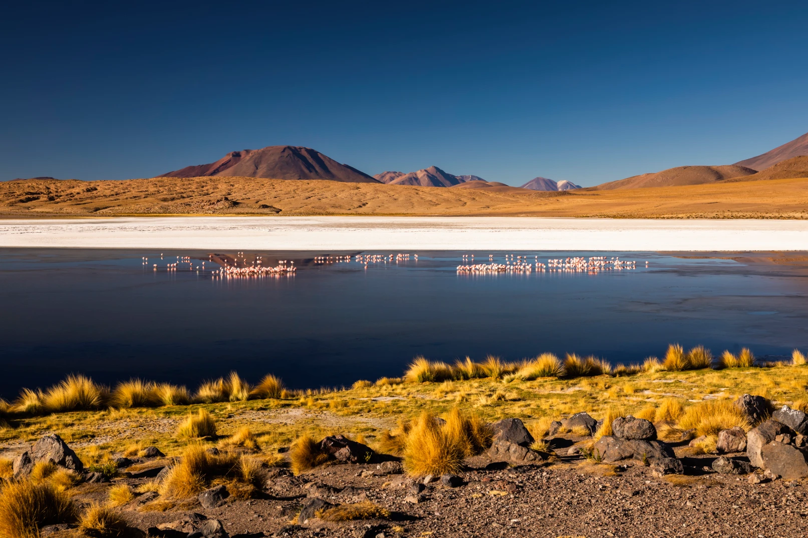
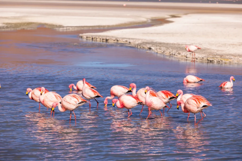
The Salar de Uyuni is home to numerous islands and islets of volcanic origin, irregularly scattered across its vast salt-covered surface. While there is no official geographic registry that confirms an exact number, geological studies and field observations indicate the presence of more than 30 islands, including larger formations and smaller rocky outcrops.
These islands are the exposed summits of ancient volcanoes and rocky uplifts that emerged after the evaporation of massive prehistoric lakes—primarily Lakes Minchin and Tauca—which covered the region more than 40,000 years ago. As water levels receded, the highest parts of the terrain surfaced as islands in the middle of the salt plain.
The islands vary significantly in size, elevation, and accessibility. Some—such as Incahuasi Island, Pía Pía, and Lomo de Pescado—are larger and can be visited, while others remain isolated, partially covered by salt, or visible only during the dry season. Many have no formal name and are not included in standard tourist routes.
From a geomorphological perspective, these formations play a key role in understanding the climatic and volcanic evolution of the Bolivian Altiplano, while also adding dramatic visual diversity to the salt flat. The islands of the Salar de Uyuni are not only striking landmarks—they are true natural archives that reveal the transformation of ancient lake ecosystems into the largest salt desert on Earth.
INCAHUASI ISLAND
A volcanic oasis in the heart of the Salar de Uyuni
Incahuasi Island is located in the center of the Salar de Uyuni, in southwestern Bolivia. This volcanic islet rises above the vast salt plain at an approximate elevation of 3,660 meters above sea level, making it one of the salt flat’s most iconic geographic highlights.
The island is composed of volcanic rock and fossilized coral—remnants of prehistoric lakes that covered the region more than 40,000 years ago. Its rugged surface contrasts sharply with the Salar’s extreme flatness, creating an abrupt terrain that can be explored along natural pathways.

Incahuasi’s most distinctive feature is its giant cacti (Echinopsis atacamensis), some of which exceed 10 meters in height and grow extremely slowly—at a rate of about 1 centimeter per year. These cacti form a unique ecosystem adapted to the Altiplano’s aridity, intense solar radiation, and wide daily temperature swings.
From the summit, you can enjoy a 360-degree panoramic view of the Salar de Uyuni, taking in its vastness and near-perfect geometry. Incahuasi is not only scenically spectacular; it also holds geological and biological significance, preserving clear evidence of the Bolivian Altiplano’s climatic and environmental evolution.
Visiting Incahuasi Island is experiencing a balance between life and desert—a mineral oasis rising from one of the most extreme and fascinating landscapes on Earth.
LOMO DE PESCADO ISLAND
An emerging volcanic formation within the Salar de Uyuni
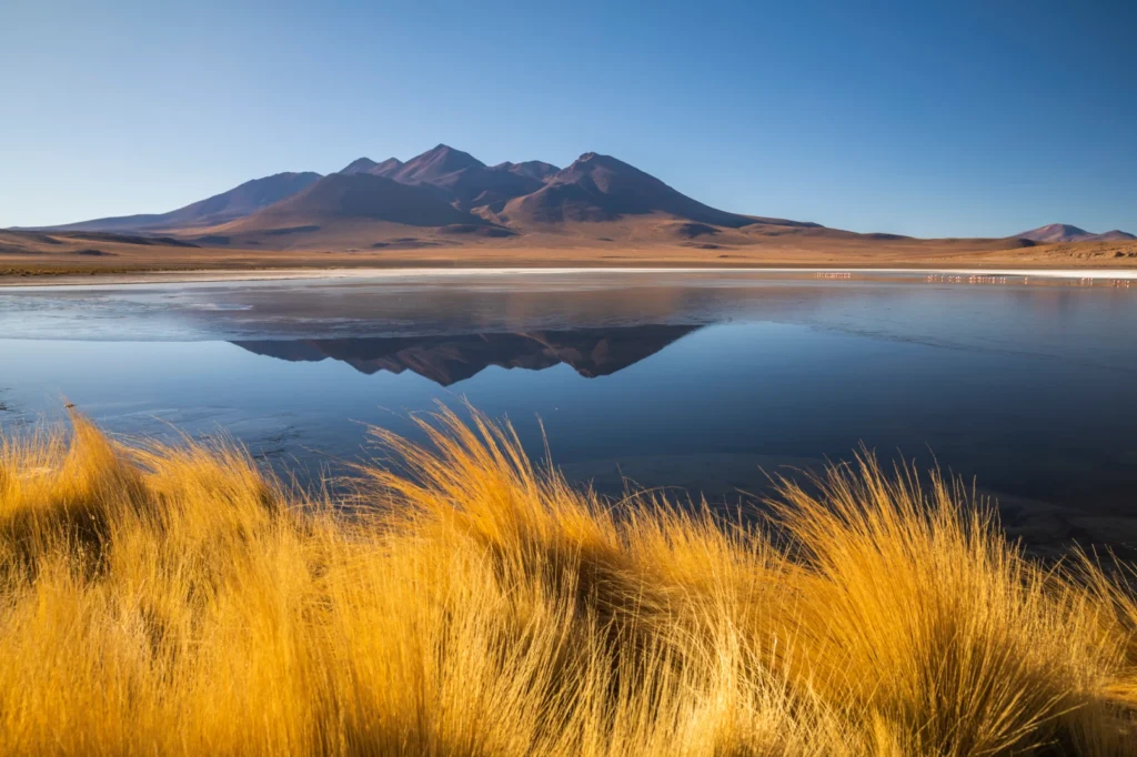
Lomo de Pescado Island is a volcanic islet located within the Salar de Uyuni in southwestern Bolivia, at an approximate elevation of 3,650 meters above sea level. Its name comes from the long, undulating shape of its terrain, resembling the back of a fish surfacing from the vast salt plain.
This formation consists of ancient volcanic rocky outcrops that were exposed after the evaporation of the great prehistoric lakes that covered the region tens of thousands of years ago. The island features irregular surfaces, eroded rock, and fossilized coral remains—clear evidence of the Salar’s lacustrine past.
Larger and less visited than other islands, Lomo de Pescado retains a natural, minimally altered character—ideal for quiet contemplation and detailed geological observation. Vegetation is sparse and composed of xerophytic species adapted to high salinity, extreme aridity, and intense solar radiation.
Lomo de Pescado adds scenic diversity and interpretive value to journeys across the Salar de Uyuni, helping visitors understand the Altiplano’s geological evolution and the striking contrast between the salt plain and the ancient volcanic relief that rises like islands in the white desert.
PÍA PÍA ISLAND
A volcanic islet on the Salar de Uyuni
Pía Pía Island is a small volcanic formation located in the eastern sector of the Salar de Uyuni, in southwestern Bolivia, at an approximate elevation of 3,650 meters above sea level. This islet emerges as solid terrain in the middle of the salt flat, offering a strong geological contrast to the Salar’s white, perfectly leveled surface.
Its structure is composed of volcanic rock and fossilized coral remains—evidence of the region’s ancient lacustrine past, when prehistoric lakes covered the Altiplano more than 40,000 years ago. Erosion and the gradual evaporation of those waters exposed these uplifts, which are now visible as islands.
Unlike better-known formations, Pía Pía is characterized by its smaller scale and minimally altered setting, making it an ideal place for quiet contemplation and geological interpretation of the Salar de Uyuni. Vegetation is sparse and made up of xerophytic species adapted to high salinity, extreme dryness, and intense solar radiation.
A visit to Pía Pía Island offers an intimate perspective on the Salar’s geological evolution, adding scenic diversity and scientific value to experiences in one of the most extraordinary natural environments on Earth.

